Backpacking Trip Strathcona Park July 3-6 2020
Strathcona Park is a huge provincial park in Central Vancouver Island. Although there are some more popular areas, much of the park is rugged with little maintenance. It is about 3.5-4.5 hours drive North from our home in Victoria, BC.
In 2018 we backpacked to the Bedwell Lakes area as a family.
In 2019 we backpacked from Forbidden Plateau to Circlet Lake, Rachel and Jason went up Mt. Albert-Edward, and then we backpacked back via the Kwai Lakes and Helen Mackenzie Lakes area.
https://www.blogger.com/blog/post/edit/443874333114751594/8579122294994627586
There is a route called the Augerpointe Traverse, which is a point to point route, most often done from Forbidden Plateau to Buttle Lake, requiring a significant car shuttle option.
So in 2020, during the pandemic, we decided to do the less popular side of the Augerpointe Traverse, backpacking up from Buttle Lake to Ruth Masters Lake and back down. We planned on this itinerary:
Sat July 4: drive up, park, hike up to first camp at pond
Sun July 5 (Ava's 7th birthday): hike to Ruth Masters Lake
Mon July 6: rest day to hang out at Ruth Masters Lake and play
Tues July 7: hike back out, likely camping at camp 2 subapline
Wed July 8: hike down back to car and drive home

Planning and getting ready...
A few interesting things were happening as we prepared for this trip:
1) It was really difficult to find dehydrated meals this year due to pandemic closures and shipping delays. I did figure it out in the end, but it took way longer than normal and my choices were limited.
2) The weather forecast for our scheduled trip looked bleak. I was imagining sunshine and warmth and swimming in alpine lakes in the sunshine, but in the days just before the trip we added more warm layers and prepared for more snow up high than I would have normally expected.
Day one: drive up, leave car, ascend 1924 feet in 2 miles (3.2km) to get to camp at pond.
This is not a popular, well marked, or well maintained trail that goes steeply up toward camp. Finding the trailhead takes some double checking and GPS work. There is only enough parking for 1-2 cars on the side of the road.
 |
| Starting out from car |
 |
| The trailhead start from the road |
 |
| Much of the early trail is full of logs |

 |
| Some logs were hard for little legs |


 |
| Buttle Lake below as we climb up |
 |
| Rachel, age 9.5, sets up her tent |
 |
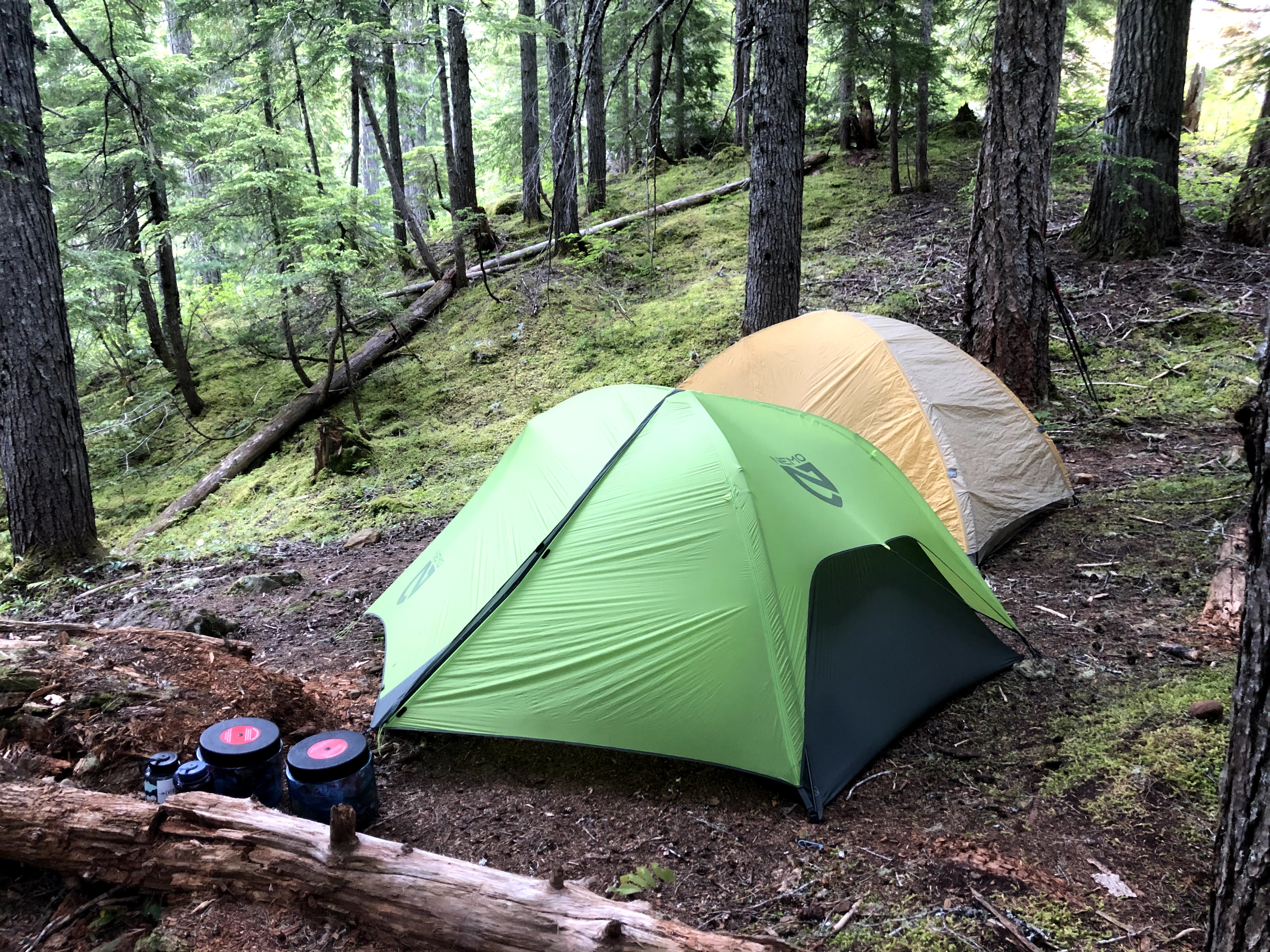
| Just room for our two 2-person tents here |

 |
| The pond / our water source |


 |
| 1 tent: Mommy Rachel, 2nd tent: Daddy and Ava |
Day two: climb up to alpine and hike to Ruth Masters Lake: 6.34 miles / 10+km, 3432 ft gain
 |
| Packing up camp to get going |
 |
| Steep climb up scree |

We left camp early and knew we had a big day ahead of us, but we seriously underestimated in our calculations. The climb up was STEEP, with some challenging scree before we reached the alpine area and camp 2. It wasn't quite as warm as we were hoping when we reached the alpine, and the weather was on/off mixes of cloud and sun. We saw a few other people, and we were excited to be in the alpine.
 |
| Way above Buttle Lake now |
 |
| Lunch at 'camp 2' alpine |

 |
| Getting to camp 2 / alpine beauty |


 |
| Destintation is behind is, not visible yet |

At one point we met some other backpackers coming toward us, and they pointed out our route ahead. I was shocked to see how far we still had to go and how much snow and exposure was ahead. Clouds were brewing, and I wasn't sure if we should push on or not. We were tired. Packs felt heavy. I didn't want it to start snowing if we were going to be navigating over deep snow on a high ridge... but we pushed on.


 |
| Ptarmigan camoflauged |

 |
| Snow gets deep and we are still climbing up |

 |
| Happy to finally see our destination: Ruth Masters Lake below |
 |
| Top of the climb and happy about it |

 |
| Starting our descent down to Ruth Masters Lake |
 |
| Waterfalls surround the lake area |
 |
| Getting to the lake and looking for a campsite |
We were very happy to get to the top on the climb and see the lake below. It was still some work descending down to the lake with slippery, icy sections and snow underfoot without a really clear trail. When we arrived at the lake, we were surprised how much recent melting there had been, leaving only a few choices for camping. We camped at our entrance side of the lake in a little grassy area that was more sheltered and avoided having to carry our packs any further, but it wasn't the driest spot. Another option would have been to carry our packs a little further to the waterfall at the far side of the lake, where more people have clearly camped, but it was more exposed to the wind and imminent rain.
 |
| Finding a campsite next to the lake and hoping it will be dry enough |


 |
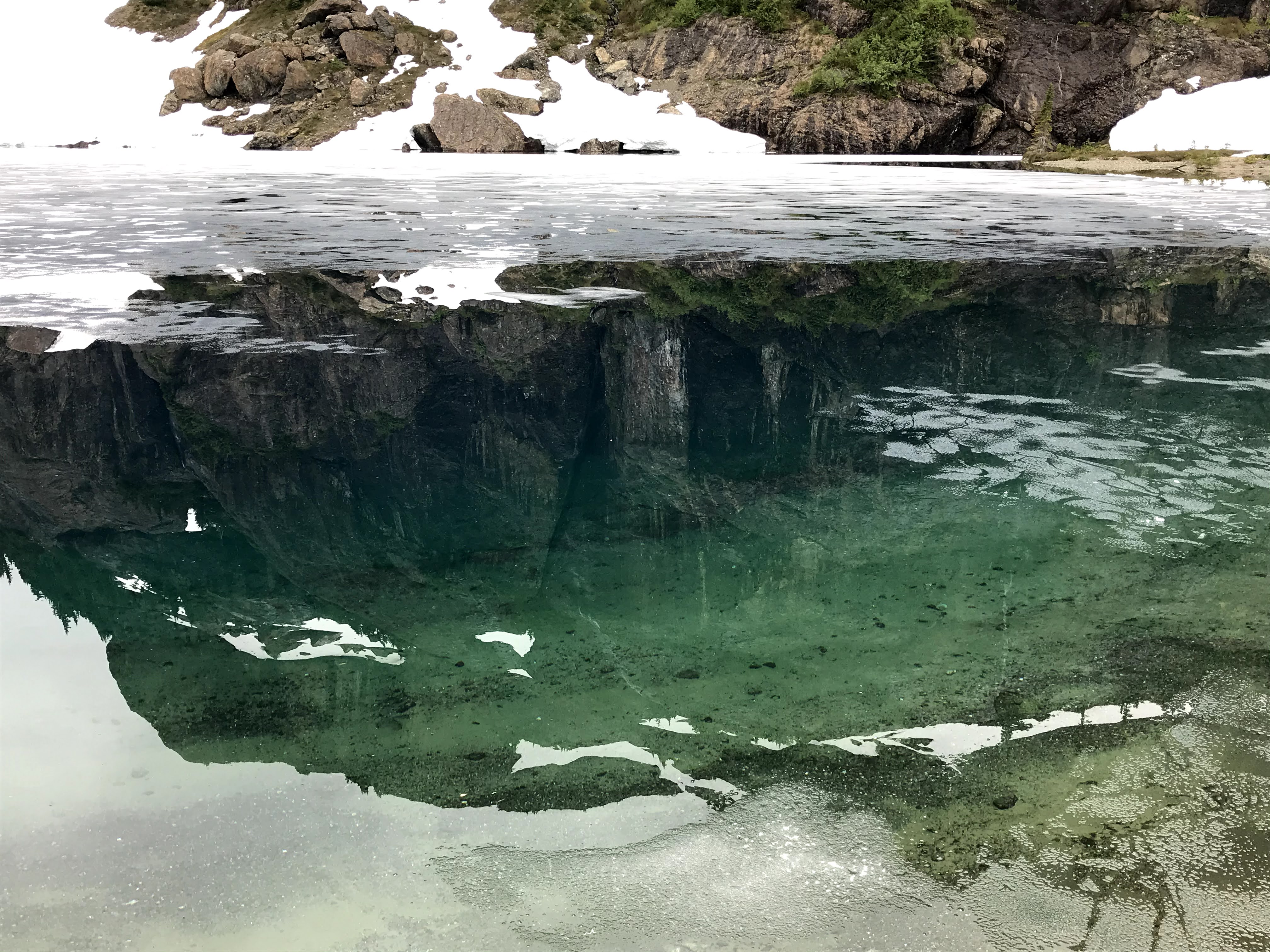
| The lake is still pretty frozen |

 |
| Happy 7th Birthday Ava! |


Day Three: rest day at the lake
We were incredibly pround of our girls for the biggest backpacking of their life through tricky conditions the day before. Everyone was pretty tired and the day of relaxing at the lake wasn't quite what I had pictured. I had pictured sunshine and warmth and games in the water... But it was cold and on/off rainy. It was beautiful, peaceful, and calm. Jason did jump in the lake, which was nuts! And we had fun playing with rocks next to the waterfall and resting up. The waterfalls everywhere were amazing, and the colour and clarity of the lake water was something else. The bugs, unfortunately, were a nuiscance.


 |
| Rachel wanted to go home |

 |
| We fit the four of us in one tent for a few games in the evening. It was crowded and smelly! |
 |
| Rachel cheered up, but was working hard to convince us that we could make it to the car the next day. Day Four: 7.12 miles back to the car We got an early start with a big day ahead of us. Everything was wet and things were grey and cold, with poor visibility. We had a big climb to get back up to the top of the ridge, with some technical and slippery terrain. Then we had to traverse along the ridge through deep snow and navigate our way back through snowfields and alpine with some rolling hills toward camp #2. We had originally planned to stay at camp#2 for the night, but it was still pretty high up in altitude and we weren't thrilled about another cold night. So we pushed on. I was so amazed by our girls and their ability to enjoy the awesome glissading opportunities and then staying safe during some gnarly steep scree descending. We barely considered another night at the pond / camp #1, and pushed on through the steep descent. My back started seizing up, and the weight of all our wet gear and the relentless downhill was pushing my limits. It was humbling to know that I was the physically-limiting factor on the descent, not my kids. I had to take little stretching breaks here and there every few mintues and I wasn't thrilled about all the logs and awkward ducking and climbing that they posed when I was so tired. But we made it back to the car, rinsed off quickly in Buttle Lake, and drove back to get a take out pizza and then home for a great sleep in a warm and cozy bed.     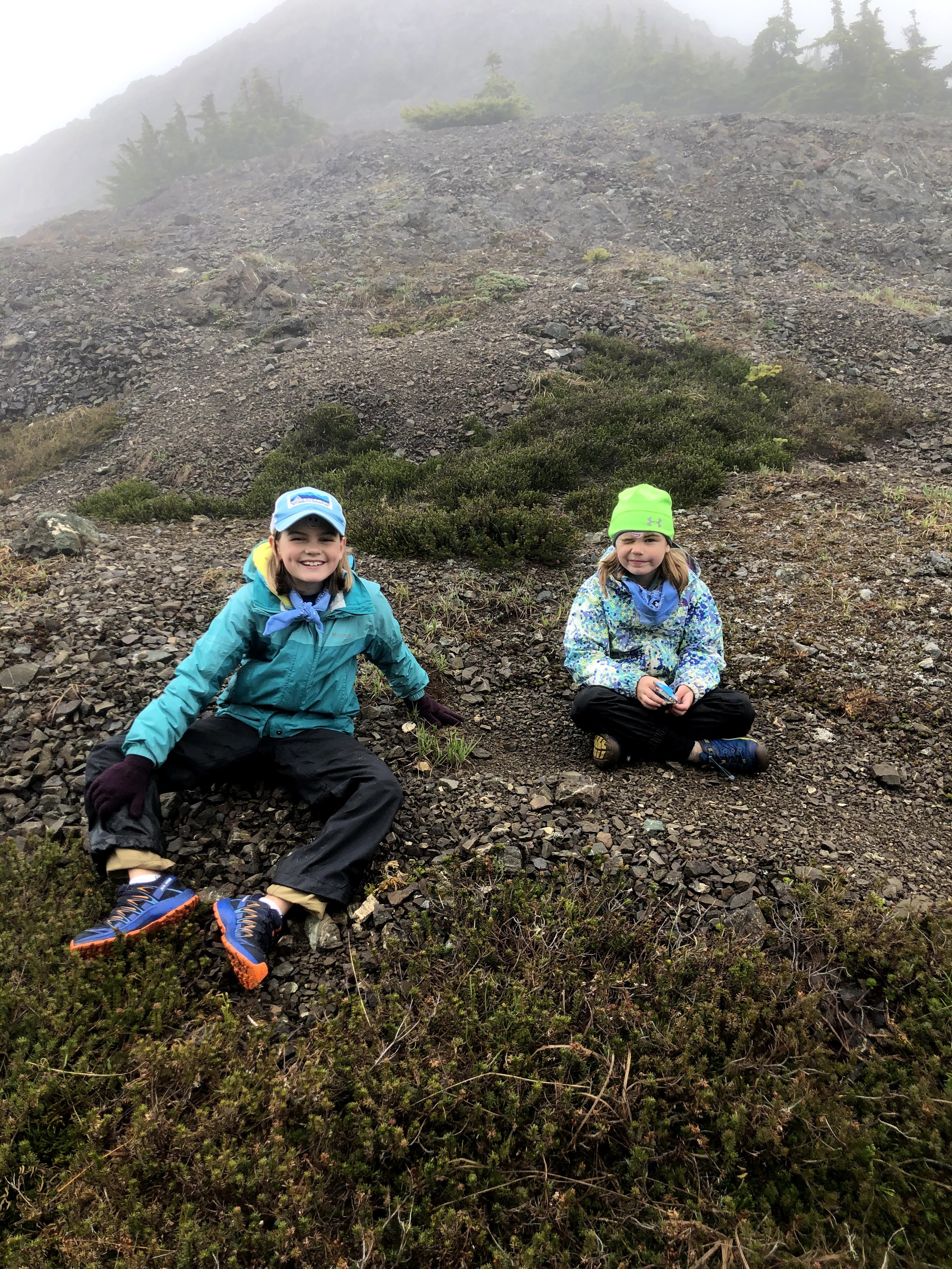  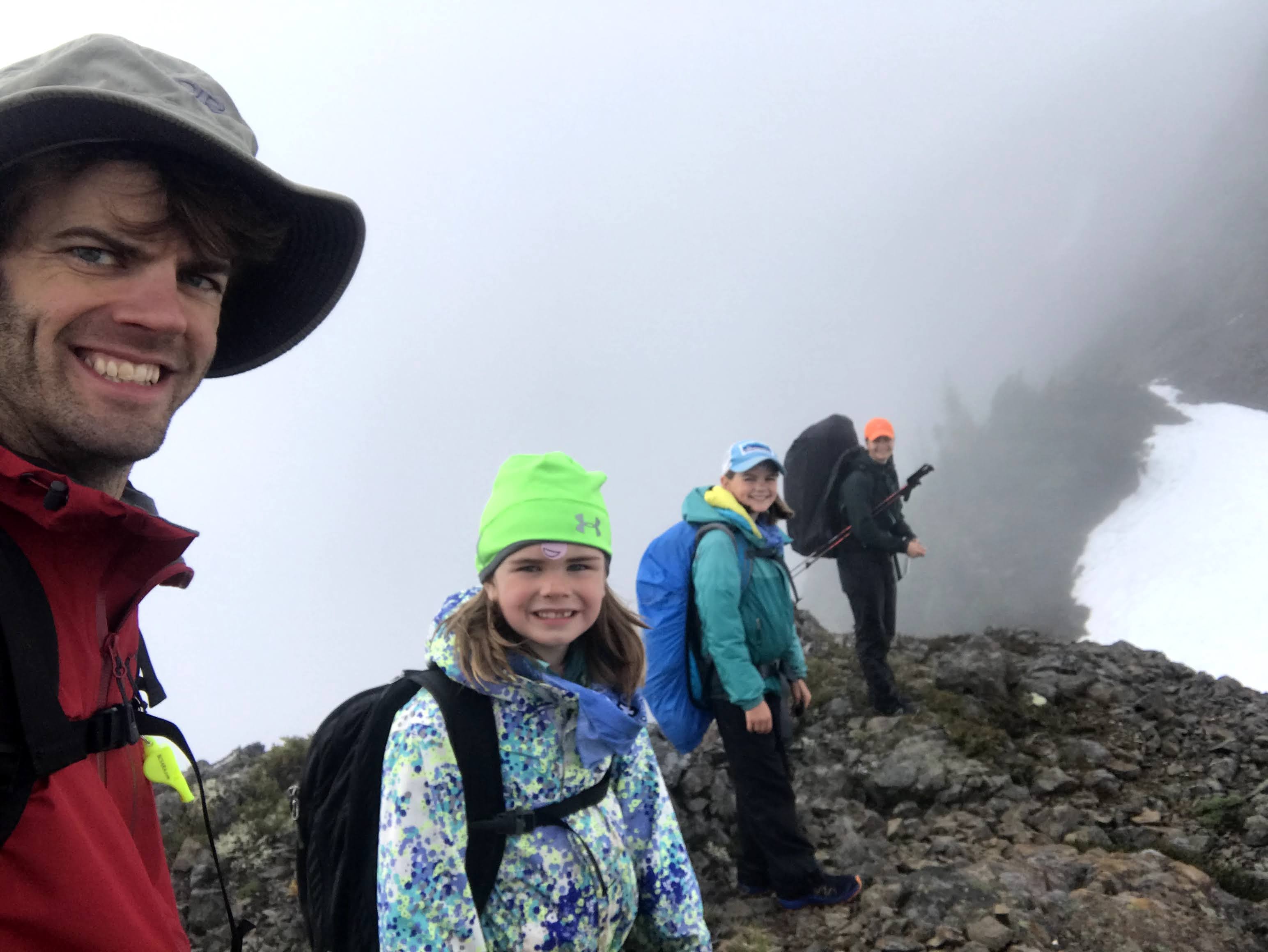          Reflections... We were blown away by our kids' physical success and perseverence through some challenges. They were able to carry more and go further than we expected. There were some grumpy moments and frustrations by each of us, but it was an awesome adventure. If we had known we could have hiked out a day early and saved ourselves carrying one extra day of food and clothes, that would have been awesome. Jason and I definitely carried more food weight than we needed to - I'm always afraid that our family will get hangry if we don't eat enough. The kids ate better this year than on previous trips, which was a relief. This was a way more challenging route / adventure than we had planned. And I'm glad, because we challenged our family more than we intended and it worked out well. Perhaps with better weather and later in the season it wouldn't have been as tough. But this was a rugged route with no facilities and no back up options. I can definitely appreciate why it is better to hike or run the full Augerpointe traverse from the Forbidden Plateau side and end with this steep, poorly maintained descent. Ascending it was pretty gross. But I am stoked that our family basically did an out and back of the route from one side last year, and from this end in 2020, so I understand what the whole traverse entails. That sounds like a fun one for another time. Later in the season when there is less snow for faster and safer travel. I hope we can do a Strathcona trip every year. But next year I'm going to have to remember to go for late July or August! |